![[Aerial Photo of Big Ear]](../bigearhp.gif)
|
|
|
|
|
|
|
![[NAAPO Logo]](../NAAPOsm.jpg) Directions to Big Ear Historical Marker |
| Each map and most photos shown below may be viewed in a larger size by clicking on the smaller-size version shown here. |
Introduction and MapsThe following text, maps, and photos are meant to help you find the Big Ear Historical Marker dedicated on November 5, 2000.
Unfortunately, in order to see what I will be referring to next, you will probably need to click on the image on the left to obtain a much larger version of Map 1, and you will probably have to go back and forth between this text and the larger version of the map. It is relatively easy to go back and forth in your browser, though. After you have obtained the large map, click the <Back> button (or equivalently, use <Alt-left arrow>) to go back to this text. You can then click the <Forward> button (or equivalently, use the <Alt-right arrow>) to go to the large map.
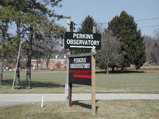
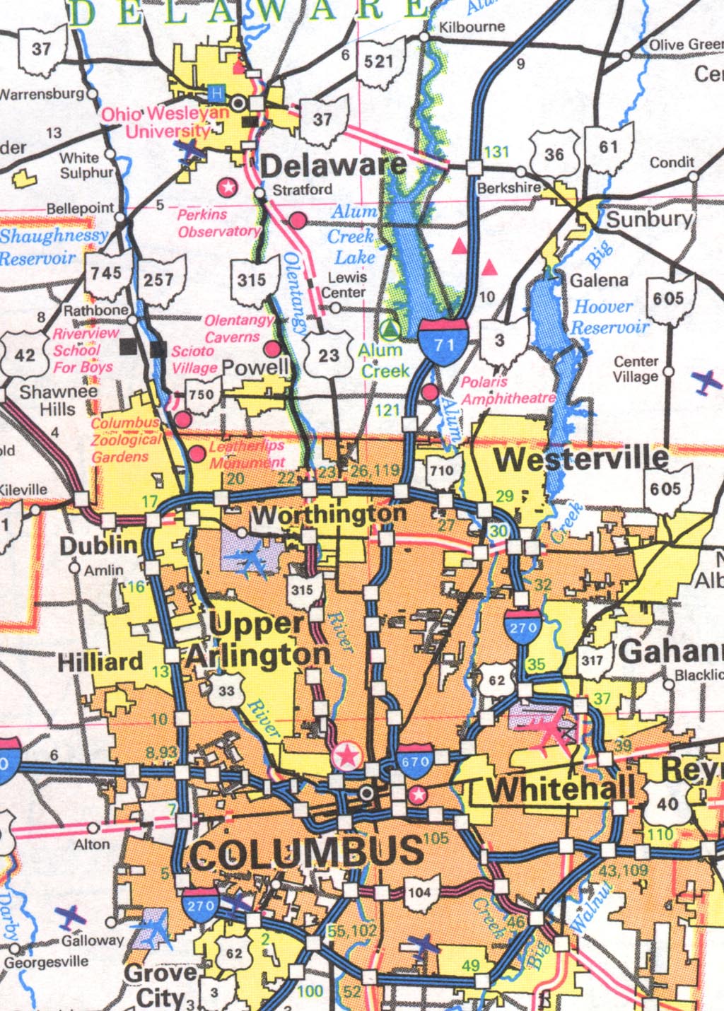
On the large Map 1 locate U.S. Rte. 23 connecting Worthington (a northern
suburb of Columbus) and Delaware. Just south of Delaware, look for the
intersection of U.S. Rte. 23 with Ohio Rte. 315 at Stratford. Follow
Rte. 23 south a short distance until you see a solid red dot; left of that
dot you will find the notation "Perkins Observatory". WARNING!! It looks
like Perkins Observatory is just off Rte. 315 but that is wrong; Perkins
Observatory is just off Rte. 23. In fact, the Big Ear marker is very near
Perkins Observatory. However, please read on because knowing that fact alone
can get you into trouble very easily.
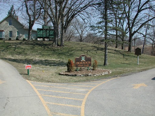
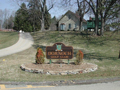
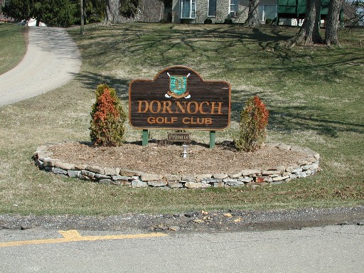
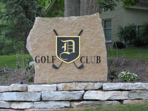
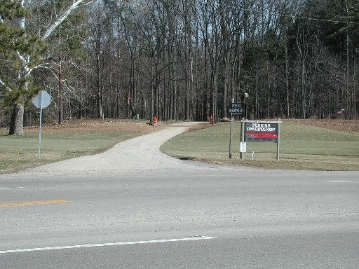
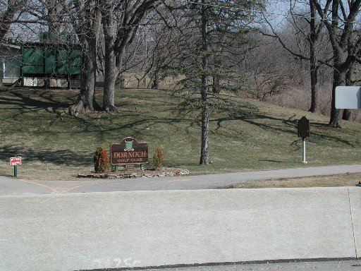
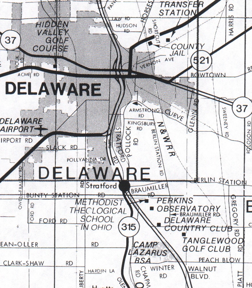
Looking at the large version of Map 2 locate the intersection of Rte. 315 and Rte. 23 (to the right (east) of Rte. 315; Rte. 23 is shown as a double line). Just below (south) of this intersection are shown 4 black squares labeled in succession from north to south: (1) Methodist Theological School in Ohio; (2) Perkins Observatory; (3) Delaware Country Club; and (4) Tanglewood Golf Club. The name for the Delaware Country Club was changed to Dornoch Golf Club and then changed again to the Delaware Golf Club.
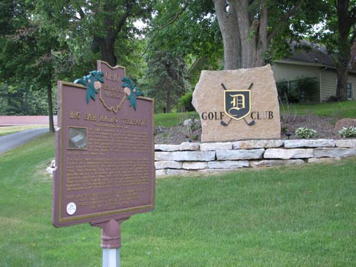
Our Big Ear marker is located just inside the entrance to the Delaware Golf Club (formerly, Dornoch Golf Club, and before that, Delaware Country Club as shown on the map). However, you had better read on, because there are certain difficulties in getting to the entrance of the Delaware Golf Club. The following photos and text should explain the
problems.
If you are coming north on U.S. Rte. 23 from Columbus or its northern suburbs (like Worthington), the directions will be straightforward. On the other hand, if you are coming south on U.S. Rte. 23 from the city of Delaware, it is much more complicated due to the unfortunate placement of concrete barriers that divide the highway. I will first describe the simple procedure when driving from the south heading north. Then I will describe the procedure when going from north to south.
Coming from South to North on U.S. Rte. 23
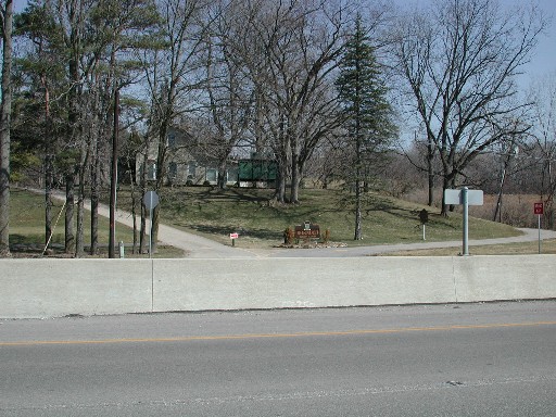
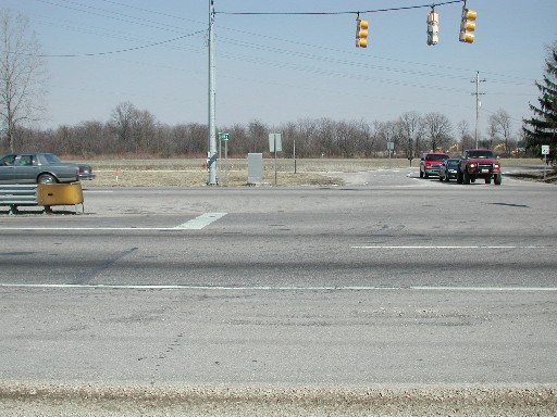
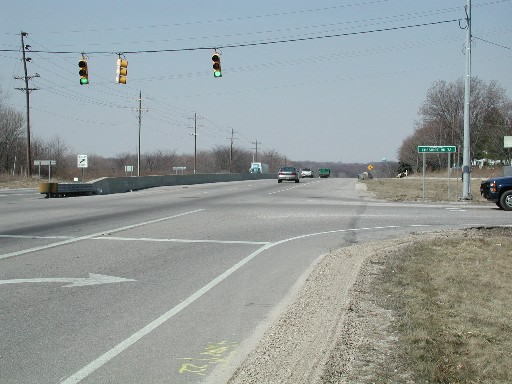
In this photo you not only see the entrance to the Delaware Golf Club (formerly, Dornoch Golf Club) and its sign, but near the right edge of the photo is our Big Ear Historical Marker.
Parking: The best place to park is on the shoulder of the road. It is
paved and wide enough so that you can get your vehicle well away from the
traffic lanes. DO NOT PARK INSIDE THE ENTRANCE TO THE GOLF CLUB! Golfers expect to be able to drive on the narrow driveway up to their parking lot (the driveway to the right), and later be able to exit (the driveway to the left); you shouldn't block those driveways.
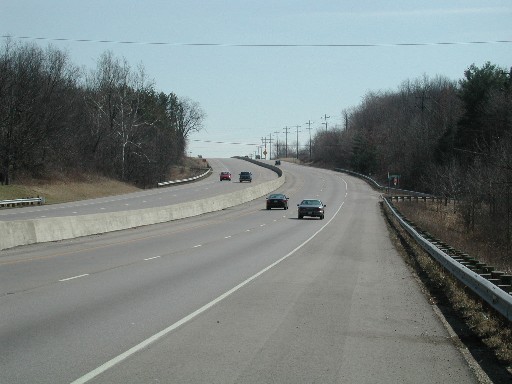
Going from North to South on U.S. Rte. 23
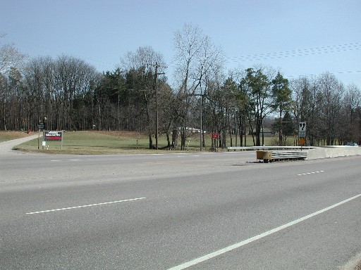
So what's next? The safest procedure is to drive past where you want to go (see the two photos below), drive up the hill staying in the left lane, turn around at the Cheshire Rd. intersection, and follow the instructions given above as if you were coming from Columbus heading north. However, continue reading and viewing photos because I have some advice for you regarding the Cheshire Rd. intersection.
If you are unable to make a U-turn due to heavy traffic, you should turn left onto Cheshire Rd., find a place to turn around, and then get back onto Rte. 23 heading north. Once you are heading north on Rte. 23, follow the instructions I gave you above for south-to-north travel.
When you are finished looking at the marker and are back in your vehicle,
look for fast traffic and be careful merging with that traffic.
If you are heading north toward Delaware, there is no problem. Just stay
in the right lane until you're up to speed.
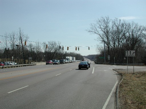
If you want to head south toward Columbus, you must be
very careful. There is no choice but to first head north. Wait
until there is little traffic, move immediately over to the left lane
keeping your speed low because you will want to make a left turn
(a U-turn) when the barrier ends (opposite the entrance (exit) to
Perkins Observatory). At the end of the barrier, start turning left but
stay in the divided area between the northbound and southbound lanes
until the southbound traffic is light enough so that you can get into
the southbound lanes and speed up to merge with the traffic.
In spite of the potential problems I've tried to warn you about when
visiting the Big Ear Historical Marker, I hope you will do so when you
are in the area.
|
Copyright © 2002-2007 Ohio State University Radio Observatory and North American
AstroPhysical Observatory.
Designed by Jerry Ehman.
Last modified: June 29, 2007.
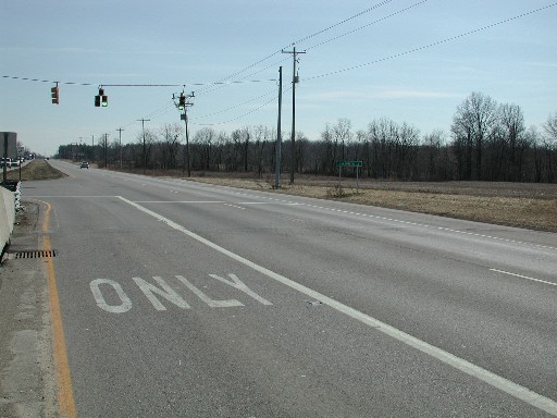
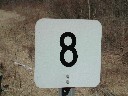 Continuing north on Rte. 23 you'll begin to go down a long hill. Near the
bottom you may spot mile marker 8 (that looks like the photo on the right).
You are now only 0.2 miles from the marker.
Continuing north on Rte. 23 you'll begin to go down a long hill. Near the
bottom you may spot mile marker 8 (that looks like the photo on the right).
You are now only 0.2 miles from the marker.